Courcelon
Origin of the name Courcelon
The village appears in 1139 as « curtem de Curzelun ». In 1320 the German form « Solendorff » is found. The name reportedly comes from « curtis Selonis », the farm (estate) of Selon. Like the other Jura place names in « cour- », it would date from the Burgundian period.[1][2]
Founding of Courcelon
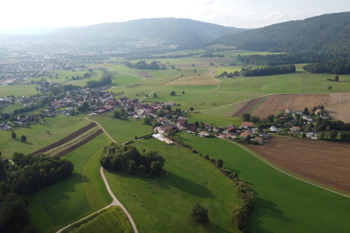
Who founded Courcelon, a village in the municipality of Courroux, east of Courroux on the slope above the Scheulte, is not known. Its name, formed on « curtis » (estate), would link it to the settlements of the Burgundian period. The site lay near the old Roman road linking Vicques to Delémont. The village shares the history of Courroux: in the Middle Ages the whole formed part of one of the thirteen free villages of the Delémont valley.[1][2]
History of Courcelon
1139. First mention of the village: « curtem de Curzelun ».[1][2]
1271. Together with Courroux, Courcelon becomes a lordship of the Bishopric of Basel (history shared with Courroux).[1][2]
1320. Mention of the German form « Solendorff ».[2]
18th-19th centuries. Iron ore mining supplements farming and the timber trade.[1]
1792-1815. Courcelon is French, like Courroux.[1][2]
1815-1978. Courcelon belongs to Bern, like Courroux.[1][2]
1838. Construction of the Sainte-Philomène chapel.[1][2]
1851. Construction of the school.[1]
1875. On the Siegfried map, the village already has a layout quite comparable to today's, with its school and dairy.[1]
2008. The village has about 300 inhabitants. Two recent residential districts have been added to the historic area.[1]
Population of Courcelon
Sources and references: [1]
| 2008 | 300 inhabitants (approximately) |
Historic sites in Courcelon
Sainte-Philomène chapel. Chapel built in 1838, topped by a small bell turret and fitted with a porch.[1][2]
Former school. Two-storey school of 1851 under a gabled roof, on a walled terrace, with three plane trees in front of its façade.[1]
Village street. The village stretches along a single street, at right angles to the Scheulte, which curves gently towards the east. It is lined with rendered masonry farmhouses, mostly from the 19th century.[1]
Sources
- Inventaire fédéral des sites construits à protéger en Suisse (ISOS), « Courcelon »
- Dictionnaire historique de la Suisse, « Courroux » (François Schifferdecker, François Kohler)
- Office fédéral de topographie swisstopo, map.geo.admin.ch
Other villages near Courcelon
Missing information, or do you have a source? Suggest a correction or addition. Every submission is checked before it's published.
Suggest a change