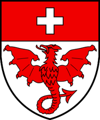
Saas-Almagell
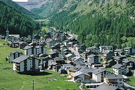
Origin of the name Saas-Almagell
The oldest known forms are « Armenzello » (1291) and « Almenkel » (1307). Names such as Almagell, Mischabel or Allalin have been explained by a Saracen settlement, but this hypothesis is considered hardly tenable. Another explanation links the form « Almelkel » to the name « Al Michél » that Italian neighbours are said to have given the place.[1][2]
Founding of Saas-Almagell
Saas-Almagell, the southernmost municipality of the Saas valley, comprises the village, part of the hamlet of Unter den Bodmen and the hamlets of Alpien, zum Moos and Furggstalden. Cup-marked stones show that the site was settled, or at least visited, in prehistoric times. The village belonged to the large commune of Saas, which came under the mayoralty (Meiertum) of Visp. Around 1300 the valley's inhabitants bought from the Blandrate, counts of Visp, the alpine pastures between the Martiswald and Mattmark. When Saas was divided into four quarters, Saas-Almagell became one of them. Its communal statutes (Bauernzünfte) regulated citizenship, the use of common land and forests, and marmot hunting. The village long belonged to the parish of Saas. The Monte Moro, Antrona and Mondelli passes linked it with northern Italy, and smuggling grew in times of economic crisis. Tourism only began in the 1890s.[1][2]
History of Saas-Almagell
1291. Recorded as « Armenzello ».[1]
1291. The people of the St. Niklaus and Saas valleys conclude the so-called Monte Rosa peace with those of the Anzasca valley, to secure trade over the passes.[2]
around 1300. The valley's inhabitants buy from the Blandrate, counts of Visp, the alpine pastures between the Martiswald and Mattmark, with the seigneurial rights attached to them.[2]
1307. Recorded as « Almenkel ».[1]
1392. The large commune of Saas divides into four quarters: Saas-Balen, Saas-Grund, Saas-Almagell and Saas-Fee.[1][2]
around 1400. The parish of Saas is formed by separation from that of Visp, with its church at Saas-Grund.[2]
1494. St. Barbara's chapel is built.[1]
1557-1763. Communal statutes (Bauernzünfte) of 1557, 1596, 1760 and 1763.[1]
1707. St. Anne's chapel is built in the hamlet of Zer Meiggeru.[1]
1890s. A first hotel opens.[1]
1893. Saas-Almagell becomes an independent parish.[1][2]
1938-1939. St. Barbara's chapel is rebuilt.[1]
1948. A road opens to traffic.[1]
1960-1965. Kraftwerke Mattmark AG builds the Mattmark dam. Territorial sovereignty over the installation lies with Saas-Almagell.[2]
1961. St. Anne's chapel at Zer Meiggeru disappears with the construction of the dam.[1]
1965. On 30 August part of the Allalin glacier collapses onto the huts of the Mattmark construction site, killing 88 workers, most of them Italian. The same year the Furggstalden ski area opens.[1][2]
1969. The Mattmark hydroelectric power station goes into service.[2]
2005. The service sector provides about 76 % of jobs.[1]
2007. The municipality's official name, until then written without a hyphen, reportedly becomes Saas-Almagell on 1 January.
2008. The municipality has over 1'800 beds and records 166'168 overnight stays.[1]
Population of Saas-Almagell
Sources and references: [1][3]
| 1850 | 147 inhabitants |
| 1900 | 190 inhabitants |
| 1950 | 335 inhabitants |
| 2000 | 397 inhabitants |
| 2025 | 376 inhabitants |
Historic sites in Saas-Almagell
St. Barbara's chapel. Village chapel built in 1494 and rebuilt in 1938-1939.[1]
Mattmark dam. Dam built from 1960 to 1965 by Kraftwerke Mattmark AG on the territory of Saas-Almagell. On 30 August 1965 the site was struck by the collapse of part of the Allalin glacier, which killed 88 people.[2]
Furggstalden. Hamlet of the municipality, with a ski area since 1965.[1]
Passes to Italy. The Monte Moro, Antrona and Mondelli passes link the Saas valley with northern Italy. They allowed Walser to settle in the Anzasca valley in the 13th century and served for smuggling.[2]
Remains in Saas-Almagell
Cup-marked stones. Stones carved with cup marks that point to prehistoric settlement or temporary use of the site.[1]
Sources
- Dictionnaire historique de la Suisse, « Saas-Almagell » (Paul Martone, trad. Florence Piguet, version du 09.02.2011)
- Dictionnaire historique de la Suisse, « Vallée de Saas » (Paul Martone, trad. Laurent Auberson, version du 06.01.2012)
- Office fédéral de la statistique (OFS), STATPOP, chiffres provisoires au 31.12.2025, via citypopulation.de
- geo.admin.ch, recherche de lieux (coordonnées)
Localities of the municipality with a page
Other villages near Saas-Almagell
Missing information, or do you have a source? Suggest a correction or addition. Every submission is checked before it's published.
Suggest a change