Orsières
Origin of the name Orsières
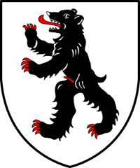
The name appears in 972 as « Pons Ursarii », then « Ursiores » in Sigeric in 990. In patois it is reportedly « Orsâïre », a form still to be confirmed. It is said to derive from « Ursarias », from Latin « ursus », the bear, like Orcières (France) or Urseren (Uri). The place may have been frequented by bears, or inhabited by hunters or bear showmen.[1]
Founding of Orsières
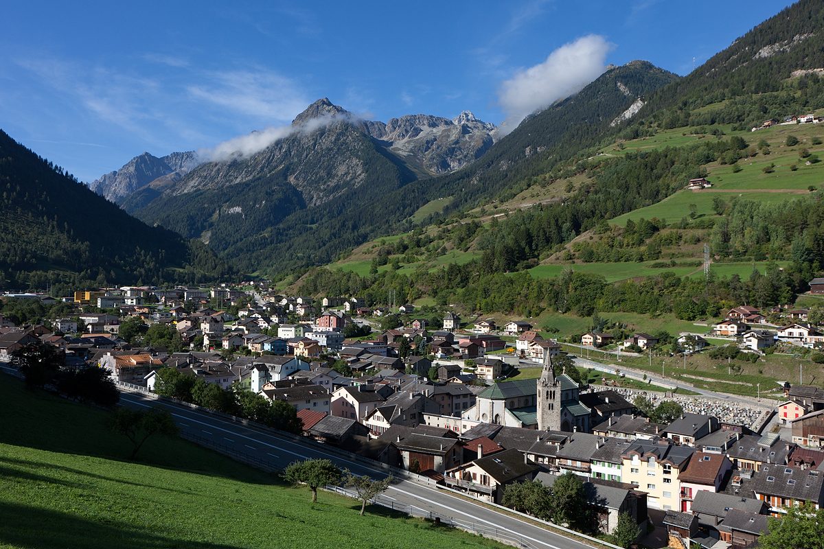
Orsières sits on the road over the Great St Bernard pass, at the foot of the Mont Blanc massif, on the French and Italian border. Its bridge, long the only one over the Dranse, appears in the very first mention of the place. In the mid-11th century the bishop of Sion ceded the village and its serfs to the cathedral chapter. From the 12th century Orsières came under the counts of Savoy and belonged, until 1798, to the castellany of Sembrancher. The community organised itself early: from the 13th century a judicial assembly settled common affairs, and later a syndic led it. Under the Ancien Régime, and probably since the Middle Ages, it was divided into three thirds: Tiers de Ville, Tiers d'Issert and Tiers des Côtes. It lived from rye, livestock, forest and vineyards at Fully and Martigny, before transport over the pass and tourism. The municipality today brings together the Val Ferret, the Champex valley, the town on the Dranse d'Entremont and hamlets such as Champex, Ferret, Issert, La Fouly and Praz-de-Fort.[1]
History of Orsières
972. First mention, « Pons Ursarii »: Saracens capture Abbot Majolus of Cluny near the bridge of Orsières.[1]
990. Sigeric lists « Ursiores » as a stage of the Via Francigena (mention not yet confirmed).
1052. Bishop Aymon of Sion gives the village and its serfs to the cathedral chapter.[1]
1150-1162. The bishop gives the church of Saint-Pantaléon to the canons of Mont-Joux. The gift is rejected by the pope in 1163, then confirmed in 1177.[1]
1189. The Count of Savoy gives the Ferret forest to the brotherhood of Mont-Joux (Great St Bernard).[1]
1228. By this date at the latest the church is dedicated to Saint-Nicolas.[1]
1352. The community is led by a syndic and placed under a métral (steward).[1]
1376. Amadeus VI of Savoy grants Orsières a charter of franchises.[1]
1475. After the defeat of Savoy, the castellany of Sembrancher, to which Orsières belongs, comes under the government of Saint-Maurice until 1798.[1]
1780s. The community obtains a new parsonage.[1]
1800. The Army of Italy marches through Orsières.[1]
1810-1813. Under French rule, Orsières belongs to the canton of Entremont, arrondissement of Saint-Maurice, in the department of Simplon.[1]
1853. The farmers found a cooperative to carry tourists and goods over the Great St Bernard.[1]
1893. The road is extended to the pass.[1]
1910. The Martigny-Orsières railway opens.[1]
1925. An alpine botanical garden is created.[1]
1935. A Reformed chapel is inaugurated in Champex.[1]
1974. A lower secondary school (cycle d'orientation) is founded.[1]
1990. Orsières takes part in the Centre régional d'études des populations alpines.[1]
Population of Orsières
Sources and references: [1][2]
| 1313 | 304 taxpayers |
| 1339 | 402 taxpayers |
| 1356 | 259 taxpayers |
| 1402 | 122 taxpayers |
| 1798 | 1'784 |
| 1850 | 2'305 |
| 1900 | 2'215 |
| 1950 | 2'286 |
| 2000 | 2'630 |
| 2025 | 3'339 |
Historic sites in Orsières
Church of Saint-Nicolas. Former church of Saint-Pantaléon, given to the canons of Mont-Joux in the 12th century and dedicated to Saint Nicholas by 1228 at the latest. A first Romanesque church was followed by a 15th-century building, then by that of the 1890s. At the start of the 21st century the parish is still served by the provostry of the Great St Bernard.[1]
Bridge of Orsières. Long the only bridge over the Dranse, it is where Abbot Majolus of Cluny was captured by Saracens in 972.[1]
Village chapels. Chapels at Commeire, La Rosière, Praz-de-Fort, Ferret, Chez-les-Reuses and Champex, where a Reformed chapel was inaugurated in 1935.[1]
Champex and the Val Ferret. Tourism began around 1850 in the Champex area, home to an alpine botanical garden since 1925. Champex and La Fouly are now ski resorts.[1]
Sources
- Dictionnaire historique de la Suisse, « Orsières » (Albano Hugon, version allemande du 03.11.2009 ; version française non lue, erreur 429)
- Office fédéral de la statistique (OFS), STATPOP, chiffres provisoires au 31.12.2025, via citypopulation.de
- geo.admin.ch, recherche de lieux (coordonnées)
Localities of the municipality with a page
Other villages near Orsières
Missing information, or do you have a source? Suggest a correction or addition. Every submission is checked before it's published.
Suggest a change