Saint-Léonard
Origin of the name Saint-Léonard
The village takes its name from the chapel dedicated to Saint Leonard, mentioned from the 11th century. It appears in 1218 as « apud Sanctum Leonardum ». The former German name is « Sankt Leonhard ».[1]
Founding of Saint-Léonard
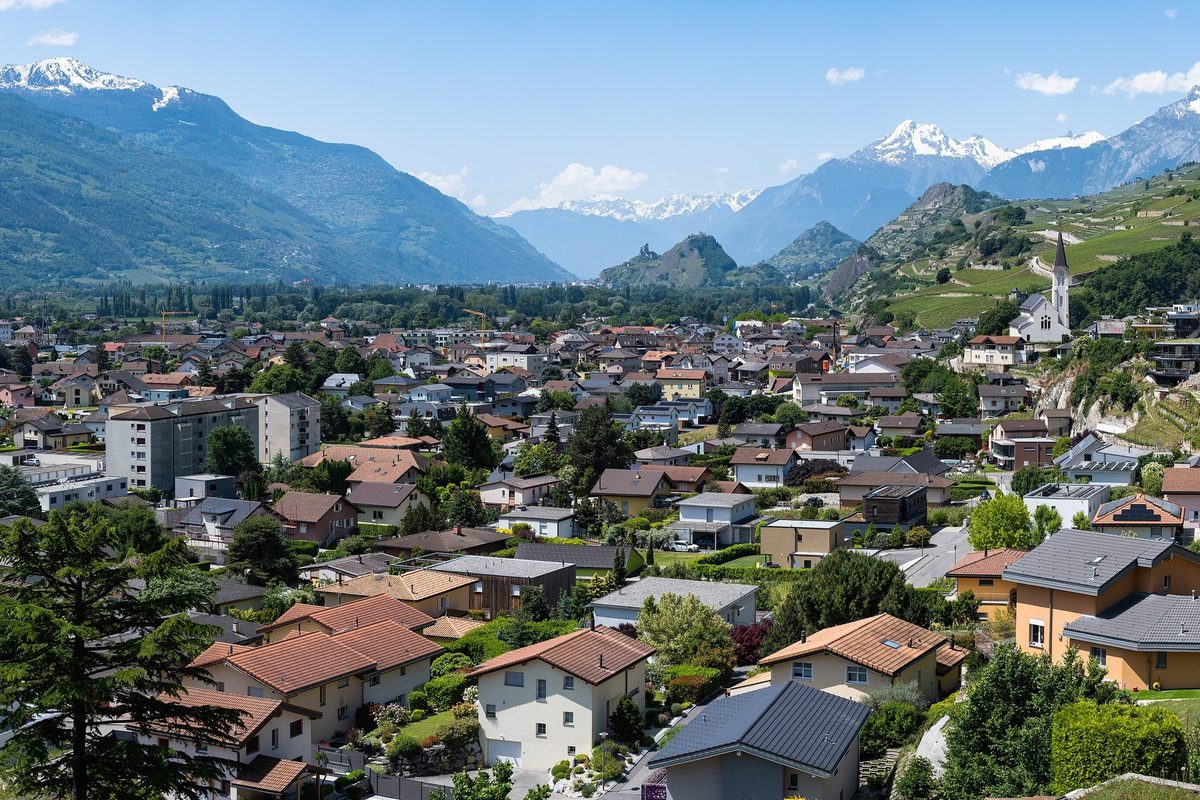
The area has been occupied since the Neolithic, notably on the spur of Sur-le-Grand-Pré. The village itself grew up on the left bank of the Lienne, at the foot of the right slope of the Rhône valley, around a chapel of Saint-Léonard that depended on the Benedictine priory of Ayent and became a parish church. In the Middle Ages Saint-Léonard belonged to the castellany of Granges, until Bishop Boson de Granges gave it to the episcopal mensa. Vassal families, the de Saint-Léonard, de Saillon and de Chevron-Villette, ran the lordship until the bishop granted it as a fief to the community, which from then on appointed its own castellan. In the 19th century the correction of the Rhône turned the plain into orchards, market gardens and vineyards. The village has spread into it since the mid-20th century and looks towards Sion and the aluminium factory at Chippis.[1]
History of Saint-Léonard
around 3700-3350 BC. Main occupation of the Sur-le-Grand-Pré site, in the Middle Neolithic, with numerous storage pits.[1]
11th century. Mention of the chapel dedicated to Saint Leonard, dependent on the Benedictine priory of Ayent.[1]
around 1200. The chapel becomes a parish church.[1]
1218. Mentioned as « apud Sanctum Leonardum ».[1]
around 1240. Bishop Boson de Granges gives Saint-Léonard to the episcopal mensa.[1]
1375. At the bridge over the Lienne, Antoine de la Tour is reportedly defeated, after the murder of Bishop Guichard Tavelli.
1556. The bishop grants the lordship as a fief to the community, which from then on appoints a castellan.[1]
1798. End of the seigneurial dues paid to the bishop.[1]
1840. Fighting at Saint-Léonard. Alexis Joris was reportedly the main military leader of Young Switzerland. In April his Lower Valais column is said to have defeated the Upper Valais forces of Louis de Courten.[5]
19th century. The correction of the Rhône transforms the plain, where orchards, market gardening and vineyards develop.[1]
1894. Construction of the neo-Gothic parish church.[1]
1912. Burkhard Reber reports the engraved rock of the Crête des Barmes.[1]
1943. Discovery of the underground lake.[2]
1949. Start of tourist use of the underground lake.[2]
1956. Discovery of the Neolithic site of Sur-le-Grand-Pré, excavated by Marc-Rodolphe Sauter until 1962.[1]
1974. Pierre Corboud studies the engraved rock of the Crête des Barmes.[1]
1975-1977. Excavations at Les Bâtiments: discovery of three cist graves of the Chamblandes type.[1]
Population of Saint-Léonard
Sources and references: [1][3]
| 1802 | 140 inhabitants |
| 1850 | 366 inhabitants |
| 1900 | 678 inhabitants |
| 1950 | 1'070 inhabitants |
| 2000 | 1'872 inhabitants |
| 2025 | 2'618 |
Historic sites in Saint-Léonard
Underground lake. The erosion of a gypsum layer formed the largest natural underground lake in Europe: 300 m long, 20 m wide and 10 m deep, 30 to 70 m beneath the vineyard. Discovered in 1943 and open to visitors since 1949, it attracts more than 100'000 visitors a year.[1][2]
Parish church of Saint-Léonard. Successor to a chapel mentioned in the 11th century that became a parish church around 1200, the present neo-Gothic church dates from 1894.[1]
Remains in Saint-Léonard
Neolithic site of Sur-le-Grand-Pré. Settlement on a rocky ridge at 498 m overlooking the Rhône plain, discovered in 1956 and excavated until 1962. Its main occupation dates from the Middle Neolithic (around 3700-3350 BC). The finds, with many rock crystal objects, pottery with grooved decoration and sawn green stones, define the « Saint-Léonard facies », a late phase of the Chassey-Cortaillod-Lagozza complex. Protohistoric and Roman remains overlie the Neolithic layer.[1]
Engraved rock of the Crête des Barmes. Rock below Sur-le-Grand-Pré, reported in 1912 and studied in 1974, showing four phases of engravings from the Neolithic to the Bronze Age and two areas of cup marks.[1]
Graves of Les Bâtiments. Three cist graves of the Chamblandes type, with crouched burials holding four, three and one individuals as well as cremated human bones, excavated in 1975-1977 and probably contemporary with Sur-le-Grand-Pré. A Middle Neolithic settlement was also identified in 1961 in the Lienne alluvial fan, beneath the present village.[1]
Sources
- Dictionnaire historique de la Suisse, « Saint-Léonard » (Alain Gallay, Bernard Truffer, version du 26.06.2012)
- Lac souterrain de Saint-Léonard, site officiel (découverte et exploitation)
- Office fédéral de la statistique (OFS), STATPOP, chiffres provisoires au 31.12.2025, via citypopulation.de
- geo.admin.ch, recherche de lieux (coordonnées)
- Dictionnaire historique de la Suisse, « Joris, Alexis » (Ignace Carruzzo), version du 12.07.2005
Localities of the municipality with a page
Other villages near Saint-Léonard
Missing information, or do you have a source? Suggest a correction or addition. Every submission is checked before it's published.
Suggest a change