Ried-Mörel
Origin of the name Ried-Mörel
The place is first mentioned in 1314 as « de riede ». What the name means is not yet known.[1]
Founding of Ried-Mörel
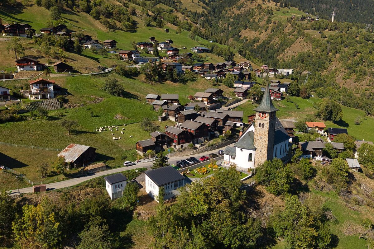
Ried-Mörel occupies a terrace between Mörel and the Riederalp and consists of many small hamlets, served by a road and a cable car. Mancapan castle, seat of the counts of Mörel, was destroyed in 1260 by Count Peter II of Savoy; its ruin survives. Ried appears as a community in 1373. It formed a joint community with Bitsch, whose oldest surviving peasant regulation (Bauernzunft) dates from 1619, and until 1798 counted as a quarter of the Östlich Raron half-dizain. Belonging to the parish of Mörel, Ried became a rectorate in 1786 and a parish in 1904. Water came via irrigation channels (Suonen) and wooden troughs from the Massa gorge at the Aletsch glacier, first mentioned in 1385. Since 1946 a 3 km tunnel has run through the Riederhorn. Farming and livestock dominated until after the Second World War, after which tourism linked to the Riederalp took over. Ried-Mörel is today in the municipality of Riederalp (merger of 1 November 2003 with Goppisberg and Greich).[1]
History of Ried-Mörel
1260. Count Peter II of Savoy destroys Mancapan castle, seat of the counts of Mörel.[1]
1314. First mention as « de riede ».[1]
1373. Ried first appears as a community.[1]
1385. First mention of the irrigation channels bringing water from the Massa gorge at the Aletsch glacier.[1]
1619. Oldest surviving peasant regulation (Bauernzunft), shared by Ried and Bitsch.[1][3]
1786. Ried becomes a rectorate of the parish of Mörel.[1]
1798. End of the Ancien Régime. Until then Ried counted as a quarter of the Östlich Raron half-dizain.[1][3]
1889. Final separation from Bitsch.[3]
1900-1901. Villa Cassel is built on the Riederfurka for the English financier Sir Ernest Cassel.[2]
1904. Ried becomes a parish.[1]
1946. A water supply through a 3 km tunnel in the Riederhorn comes into service.[1]
2000. 58 % of the working population work in tourism.[1]
2003. On 1 November, merger with Goppisberg and Greich into the new municipality of Riederalp.[1][2][4]
Population of Ried-Mörel
Sources and references: [1]
| 1850 | 302 inhabitants |
| 1900 | 333 inhabitants |
| 1950 | 292 inhabitants |
| 2000 | 304 inhabitants |
Historic sites in Ried-Mörel
Irrigation channels and Riederhorn tunnel. Irrigation channels and wooden troughs, mentioned from 1385, brought water from the Massa gorge at the Aletsch glacier. Since 1946 it has flowed through a 3 km tunnel under the Riederhorn.[1]
Villa Cassel. Built in 1900-1901 on the Riederfurka, above the alpine pastures of today's Riederalp, for Sir Ernest Cassel, who sometimes spent the summer there with family and guests, including the young Winston Churchill. Located in the Aletsch forest nature reserve, it now houses the Pro Natura Aletsch centre.[2]
Riederalp. The alpine pastures partly worked in common by Ried, Greich and Goppisberg, at about 1930 m, became in the second half of the 20th century the summer and winter resort of Riederalp, which gave its name to the merged municipality.[2]
Remains in Ried-Mörel
Ruin of Mancapan castle. Seat of the counts of Mörel, the castle was destroyed in 1260 by Count Peter II of Savoy. It survives as a ruin.[1]
Sources
- Historisches Lexikon der Schweiz, « Ried-Mörel » (Anton Riva, version du 05.01.2017, version allemande)
- Historisches Lexikon der Schweiz, « Riederalp » (Anton Riva, version du 05.01.2017, version allemande)
- Historisches Lexikon der Schweiz, « Bitsch » (Philipp Kalbermatter, version du 02.06.2004, version allemande)
- Office fédéral de la statistique, Répertoire officiel des communes, mutation n° 2268 (01.11.2003)
- geo.admin.ch, recherche de lieux (coordonnées)
Localities of the municipality with a page
Other villages near Ried-Mörel
Missing information, or do you have a source? Suggest a correction or addition. Every submission is checked before it's published.
Suggest a change