Mont-Terri
Origin of the name Mont-Terri
The origin of the name « Mont-Terri » is unknown. The summit is also known locally as « Camp de Jules César », and the medieval tower is reportedly the « Château Thierry » named in texts of the time, though this is not confirmed.
Founding of Mont-Terri
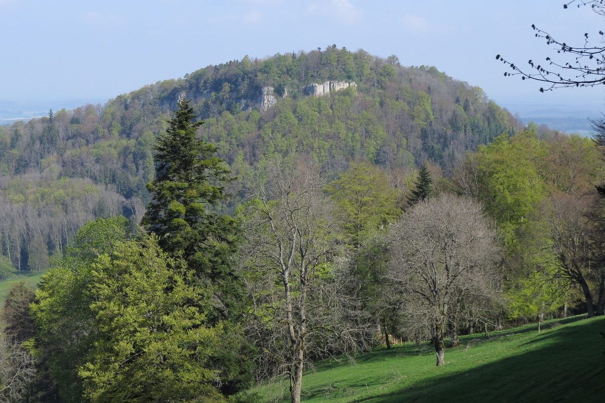
Mont-Terri is a massif about 800 m high, standing out on the northern flank of the Jura chain on the route over the Col des Rangiers, in the municipality of Cornol. Its summit, a plateau of about 4 hectares bordered by cliffs to the south and west, overlooks Ajoie and the Belfort Gap. It served as a defensive and lookout site from prehistoric times. Visited in the Neolithic, it was fortified several times from the Bronze Age to late Antiquity, then carried a tower in the Middle Ages. Researchers have been interested in it since the 18th century.[1][2]
History of Mont-Terri
Neolithic. Polished axes and flint tools, including arrowheads, point to human presence.[1][2]
Around 1250 BC. First fortification of the northern and eastern edges of the summit, at the start of the Late Bronze Age.[1]
Hallstatt period. A few objects suggest the existence of a grave.[1]
Early 1st century BC. A Celtic settlement occupies the summit. It is thought to have been deliberately destroyed and replaced by a large dry-stone rampart with a timber frame (murus gallicus), events perhaps linked to the exodus and return of the Helvetii and Rauraci in 58 BC.[1]
Around 260. After a period of abandonment, a new wooden palisade is built at the time of the first great Alamannic invasions.[1]
Mid-4th century. A Roman garrison is stationed on the summit.[1]
10th century. Finds extend into this period, including a silver denier minted in Basel under Louis IV the Child (899-911).
13th century. A stone tower is built at the highest point, probably replacing a wooden one. A Carolingian origin of the tower has also been suggested.
1618-1648. Mont-Terri serves as a refuge during the Thirty Years' War.[1]
Early 18th century. The Jesuit father Dunod places Caesar's camp of the campaign against Ariovistus on the site.
1840-1862. The owners Koeckler and Maupassant dig the site from 1840 to 1845. Auguste Quiquerez, who publishes « Le Mont-Terrible » in 1862, accuses them of having buried the objects before finding them, which proves true.
1932-1933. Excavations by Alban Gerster, more rigorous than earlier ones.
1984-1987. Excavations by the University of Basel in 1984, 1985 and 1987, supported by the Swiss National Science Foundation and the canton of Jura.[1]
Historic sites in Mont-Terri
Summit plateau. Plateau of about 4 hectares at some 800 m, bordered by cliffs to the south and west, overlooking Ajoie and the Belfort Gap. It is listed in category A (national significance) of the Swiss inventory of cultural property as a Bronze Age to Roman site and medieval castle ruins.[1][3]
Remains in Mont-Terri
Ramparts. The summit was fortified around 1250 BC along its northern and eastern edges, then in the 1st century BC by a dry-stone rampart with a timber frame, and finally around 260 by a wooden palisade.[1]
Medieval tower. At the highest point of the plateau, within an enclosure, the scant ruins of a medieval tower survive.[1]
Legends of Mont-Terri
Julius Caesar's camp. The summit is known locally as « Camp de Jules César ». From the early 18th century, Caesar's camp of the campaign against Ariovistus was placed here.
Sources
- Dictionnaire historique de la Suisse, « Mont-Terri » (François Schifferdecker), version du 02.12.2008
- Dictionnaire historique de la Suisse, « Cornol » (Dominique Prongué)
- Office fédéral de la protection de la population (OFPP), Inventaire PBC, liste cantonale du canton du Jura (état au 1.1.2026)
- geo.admin.ch (swisstopo), recherche de lieux « Mont Terri »
Other villages near Mont-Terri
Missing information, or do you have a source? Suggest a correction or addition. Every submission is checked before it's published.
Suggest a change