Moulin de Vert
Origin of the name Moulin de Vert
The site is named after the mills that stood there between the 15th and 19th centuries and were destroyed over time by natural disasters. The Moulin de Vert, built on the old bed of the Rhône, disappeared in 1939. The meaning of « Vert » is unexplained.[1][2]
Founding of Moulin de Vert
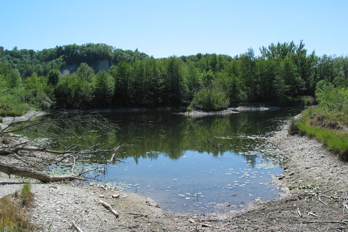
The site lies north of the village of Cartigny, in the municipality of Cartigny, at the foot of the cliffs. It is a former meander of the Rhône, the « boucle de Cartigny », where mills operated between the 15th and 19th centuries. With the last correction of the Rhône, around 1940, and then the canal of the Verbois dam built in 1943, the meander was cut off from the canalised river and dried out. The site was protected from 1956 and became a nature reserve in 1970. Ponds were dug from 1976 to restore the diversity of the habitat.[1][2][4][5]
History of Moulin de Vert
15th-19th century. Mills operate on the site. They are destroyed over time by natural disasters. The last one in operation is the Dufour mill.[2]
1939. The Moulin de Vert, built on the old bed of the Rhône, disappears.[1]
1940. The meander becomes inactive with the last correction of the Rhône. It dries out in the 1940s.[2][4]
1943. Construction of the Verbois dam, whose canal isolates the former meanders of Moulin-de-Vert and Les Teppes.[4]
1956. The former meander at the foot of the cliffs is protected as a natural site of national importance.[2]
1970. Creation of a nature reserve, with regulations on its protection.[1][2]
1976. The site becomes a Ramsar site. The « Est » pond is deepened and reshaped.[2]
1977. Listed in the Federal Inventory of Landscapes and Natural Monuments (object 1204).[2]
1978. The « des Isles » pond is dug.[2]
1991. Beavers arrive and have since moved between the banks of the Rhône and the ponds.[2]
1992. The reserve is extended to the Prés de Bonne. The « Hainard » pond is dug in an old hollow.[2]
2001. First management plan for the reserve.[2]
2009. The site joins the Emerald Network (Bern Convention).[2][3]
2013. The current perimeter is designated a nature reserve and the management plan is revised. It also covers the neighbouring Bois de Treulaz.[2][3]
Historic sites in Moulin de Vert
Reserve and ponds. The reserve covers 48 hectares, about 7 of them ponds. It has the largest number of breeding bird species in the canton.[2]
Bois de Treulaz. Neighbouring nature reserve since 2009, linked to Moulin-de-Vert by a path of about fifteen minutes.[3]
Remains in Moulin de Vert
Dufour mill. A few remains of the Dufour mill, the last mill in operation, are still visible on the slopes of Cartigny.[2]
Sources
- Dictionnaire historique de la Suisse, « Cartigny » (Catherine Santschi), version du 28.06.2005
- République et canton de Genève, Direction générale de l'agriculture et de la nature, « Réserve naturelle Moulin de Vert, Cartigny », mai 2017
- République et canton de Genève, Direction générale de l'agriculture et de la nature, « Réserve naturelle Bois de Treulaz », juillet 2016
- Office fédéral de l'environnement, Inventaire fédéral des paysages (IFP), objet 1204 « Rhône genevois, Vallons de l'Allondon et de la Laire »
- geo.admin.ch, service de recherche de swisstopo (lieu-dit Moulin de Vert, Cartigny, coordonnées)
Other villages near Moulin de Vert
Missing information, or do you have a source? Suggest a correction or addition. Every submission is checked before it's published.
Suggest a change