Erschmatt
Origin of the name Erschmatt
Recorded in 1328 as « Huers » and in 1357 as « Hoers ». In dialect the village is called « Eersch ». The etymology remains unexplained.[1]
Founding of Erschmatt
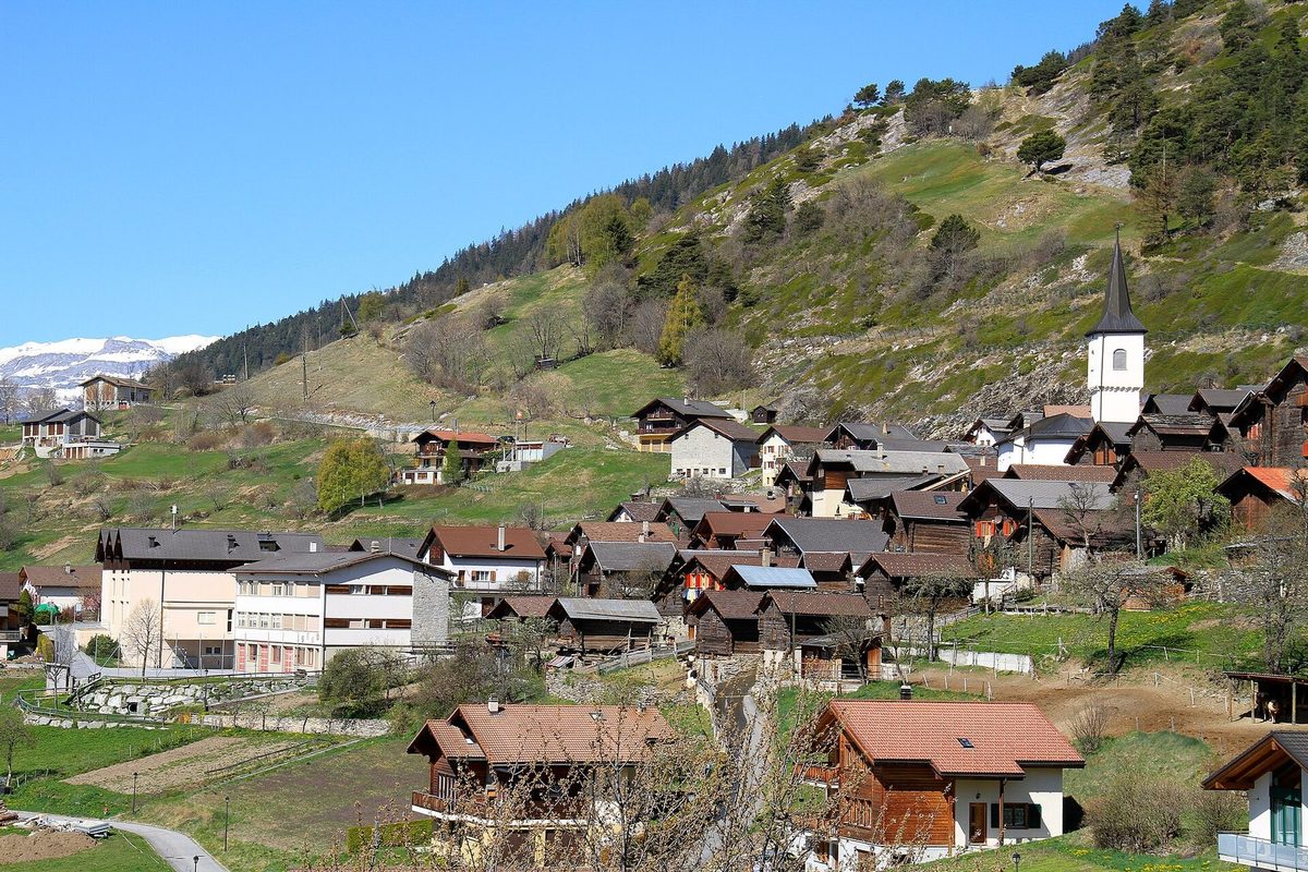
Erschmatt lies at 1'230 metres in the Leuker Sonnenberge, on the sunny slope of the right bank of the Rhone. Iron Age and Roman graves attest an early presence, but the German-speaking settlement goes back to Alemannic settlers who came over the Bernese passes towards the end of the first millennium. The village appears as an autonomous municipality, adopts statutes and belongs to the Leuk dizain. First part of the parish of Leuk (Loèche), it became a parish and built its church, probably on the site of an older chapel. On the Zelg terraces rye was grown under a two-field system, a tradition kept alive today by the Erlebniswelt Roggen.[1][2][5]
History of Erschmatt
1st century BC. Iron Age graves above the village.[1]
1st century. Roman-period graves at the eastern exit of the village, along the old church path from Bratsch.[1]
1328. Recorded as « Huers ». The autonomous municipality is attested.[1][2]
1357. Recorded as « Hoers ».[1]
1469. Consecration of a St John chapel on the site of the present church.[2]
1535. First municipal statutes.[1][2]
1563. The arched bridge over the Feschelbach, called Hohe Brücke or Teufelsbrücke, is mentioned as « neue Brücke ».[1]
1691. Construction of a chapel at the eastern bridgehead.[1]
1710. Erschmatt separates from the parish of Leuk and becomes a parish.[1][2]
1710-1712. Construction of the church, probably on the site of an older chapel.[1]
1798. End of membership of the Leuk dizain.[1][2]
1864. Construction of the municipal house.[2]
1897. Farmers start working at Lonza in Gampel, then from 1908 at Alusuisse in Chippis.[1]
1956. The road, built in stages, reaches Erschmatt.[1]
1963. Worker-farmers now work mainly at Alusuisse in Steg.[1]
1966. A concrete bridge carries the road to Leuk and links Erschmatt with the Rhone valley.[1]
1985. Opening of the variety garden and the Erlebniswelt Roggen, devoted to rye.[5]
2013. Erschmatt is incorporated into the municipality of Leuk.[1]
Population of Erschmatt
Sources and references: [1][2]
| 1802 | 180 inhabitants |
| 1850 | 194 inhabitants |
| 1900 | 323 inhabitants |
| 1950 | 267 inhabitants |
| 2000 | 302 inhabitants |
| 2012 | 279 inhabitants (unconfirmed) |
Historic sites in Erschmatt
St Michael's church. Parish church built in 1710-1712, after the parish was created in 1710, probably on the site of an older chapel.[1][3][4]
Hohe Brücke (Teufelsbrücke). Arched bridge over the Feschelbach gorge, mentioned in 1563 as « neue Brücke », with a chapel built in 1691 at its eastern end. Since 1966 paralleled by a concrete bridge.[1][3]
Zelg terraces. Terraces between 1'200 and 1'500 metres where rye was grown under a two-field system until the 1960s.[1]
Sortengarten and Erlebniswelt Roggen. Garden of traditional Valais varieties (rye, barley, wheat, field beans, peas) and a place devoted to rye growing and rye bread, opened in 1985.[5]
Brentschen. Mayen (maiensäss) at 1'540 metres, probably once inhabited all year round.[1]
Hoher Spycher. Granary nearly 400 years old standing on pillars in the oldest quarter of the village, near the church.[4]
Remains in Erschmatt
Iron Age graves. Burials from the 1st century BC found above the village.[1]
Roman graves. Burials from the 1st century AD found at the eastern exit of the village, along the old church path from Bratsch.[1]
Sources
- Dictionnaire historique de la Suisse (version allemande), « Erschmatt » (Werner Bellwald, version du 04.01.2017)
- Inventaire fédéral des sites construits à protéger en Suisse (ISOS), « Erschmatt », n° 4917 (2e version, 08.1997)
- Office fédéral de la protection de la population (PBC), « Révision Inventaire PBC 2021 : liste cantonale du canton du Valais » (état au 1.1.2026)
- Erschmatt, « Sights » (église Saint-Michel, Hoher Spycher)
- Musées suisses, « Sortengarten und Erlebniswelt Roggen Erschmatt »
- geo.admin.ch, recherche de lieux (coordonnées)
Localities of the municipality with a page
Other villages near Erschmatt
Missing information, or do you have a source? Suggest a correction or addition. Every submission is checked before it's published.
Suggest a change