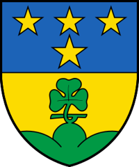
St. Niklaus
Origin of the name St. Niklaus
Early forms are « chousun » (1233), « ecclesia Sancti Nicholai de Chouson » and « Gebreitun de Gazun » (1272), « in villa sti nicolai de chosun » (1388). The dedication to Saint Nicholas, attested for the church in 1272, gave its name to the parish and later to the municipality; the name St. Niklaus prevailed for the whole municipality in the 19th century. The French form is Saint-Nicolas. In dialect the village is reportedly called « Zaniglas ».[1]
Founding of St. Niklaus
La Tène graves and a burial from the 1st millennium BC attest Celtic settlement (Uberi), which the Alemanni Germanised in the 8th and 9th centuries. In the Middle Ages the vidomnat of Chouson was a fief of the Bishop of Sion, where the Raron family (before 1268), the de la Tour, the Blandrate and the de Platea held seigneurial rights in turn. When noble lordship ended, St. Niklaus formed an autonomous majorie whose major exercised high justice. Under the Ancien Régime this majorie formed one of the quarters of the dizain of Visp together with the free jurisdiction of Kipfen and the majorie of Zermatt. The parish, attested from the early 13th century, then covered the whole valley. Zermatt, Täsch, Randa and Herbriggen later broke away. Divided into four districts that became municipalities, the municipality was reunited between 1820 and 1870. It includes Riedmatten, Dorf, Stalu, Ze Schwidernu, Mattsand, Herbriggen and Breitmatten in the valley, and Gasenried on the eastern slope.[1]
History of St. Niklaus
1st millennium BC. Burial with bracelets and jewellery, discovered in 1971.[1]
Late Iron Age (La Tène). About twenty stone-cist graves, discovered in 1881, show Celtic settlement.[1]
8th-9th centuries. The Celtic population is Germanised by the Alemanni.[1]
Early 13th century. St. Niklaus is attested as a parish.[1]
1233. Mention as « chousun ».[1]
1234-1375. The de la Tour hold seigneurial rights, as do the Blandrate from 1249 to 1365.[1]
1272. First mention of the dedication to Saint Nicholas: « ecclesia Sancti Nicholai de Chouson ».[1]
around 1290. Zermatt breaks away from the great parish.[1]
1365-1528. The de Platea hold seigneurial rights.[1]
1423. Täsch breaks away from the great parish.[1]
1552. The castellany of Randa-Täsch is attached to the majorie of St. Niklaus.[1]
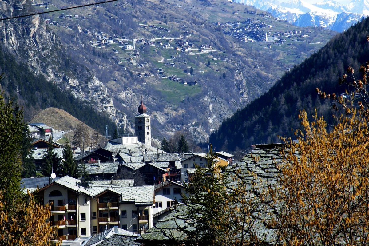
17th century. The onion-domed tower, today the emblem of the village, is built.[1]
1730. Randa breaks away from the great parish.[1]
1798. The four districts (Dorfmark, Innere Matt, Äussere Matt and Gasenried) become municipalities. The two Matt reunite before 1820.[1]
1866. The Dorfmark joins the reunited municipality.[1]
1867. The municipality builds the Grand Hotel, followed by other hotels.[1]
1870. Gasenried joins the municipality.[1]
1891. The railway runs through the valley to Zermatt. Some tourists no longer stop in St. Niklaus.[1]
1933. Herbriggen breaks away from the parish.[1]
1937. The road to Visp opens.[1]
1947. A branch of Scintilla settles in the former Grand Hotel converted into a factory, with about 300 employees in the first year; emigration is halted.[1]
1955-1956. The first new factory building is constructed.[1]
2005. The plant, part of the Bosch group, has 385 employees and is the world's leading saw-blade manufacturer. The secondary sector provides about 55 % of jobs in the municipality.[1]
Population of St. Niklaus
Sources and references: [1][3]
| 1798 | 450 inhabitants |
| 1850 | 551 inhabitants |
| 1900 | 922 inhabitants |
| 1950 | 1'604 inhabitants |
| 2000 | 2'304 inhabitants |
| 2025 | 2'346 inhabitants |
Historic sites in St. Niklaus
Church of Saint Nicholas and onion-domed tower. Church of the former great parish of the Mattertal, whose dedication, attested in 1272, gave the municipality its name. Its 17th-century onion-domed tower is the emblem of the village.[1]
Meierturm and mountain guides' museum. Tower in the old village centre which since 2000 has housed a mountain guides' museum, together with a mineral exhibition and a local museum. It is said to date from 1273 and to be the oldest surviving building in the Mattertal.[2]
Former Grand Hotel. Hotel built in 1867 by the municipality, when St. Niklaus was a stage on the path from Visp to Zermatt. It was converted into a factory when Scintilla settled there in 1947.[1]
Gasenried. Bergschaft on the eastern slope, a former district that became a municipality in 1798 and rejoined St. Niklaus in 1870.[1]
Herbriggen. Locality in the valley, a parish since 1933.[1]
Remains in St. Niklaus
Celtic graves. About twenty La Tène stone-cist graves, discovered in 1881, and a burial from the 1st millennium BC with bracelets and jewellery, uncovered in 1971.[1]
Legends of St. Niklaus
Saint Nicholas and the landslide. According to tradition, two kobolds tried to topple the Dorftossen to bury the valley, but Saint Nicholas stopped them and saved the village. St. Niklaus Dorf itself is said to stand on a buried village.
Sources
- Historisches Lexikon der Schweiz, « St. Niklaus (VS) » (Bernard Truffer, version du 06.01.2012)
- Association des musées suisses (museums.ch), « Bergführer-, Heimat und Mineralienmuseum », St. Niklaus
- Office fédéral de la statistique (OFS), STATPOP, chiffres provisoires au 31.12.2025, via citypopulation.de
- geo.admin.ch, recherche de lieux (coordonnées de St. Niklaus)
Other villages near St. Niklaus
Missing information, or do you have a source? Suggest a correction or addition. Every submission is checked before it's published.
Suggest a change